


The Namaqualand Spring Flowers - a Road Trip [day 4 of 5]: Wildeperdehoek Pass and the Messelpad
The spring poetry of Namaqualand; 14 - 18 Aug 2024

I’ve been reading “Land of the Thirst King”1, albeit very slowly. In this book, Willem Steenkamp describes the discovery of copper by Simon van der Stel in 1685 (and probably the Khoi, San and Nama previously).
“Van der Stel had decided - correctly - that there was just no way for a mining industry centred on the copper mountain to pay its way… But by 1876 those difficulties had been overcome, if not very efficiently.” By wagon, 73 miles to Hondeklipbaai. “…the old copper road, which had now become known as the ‘Messelpad’, or Masonry Road.”2
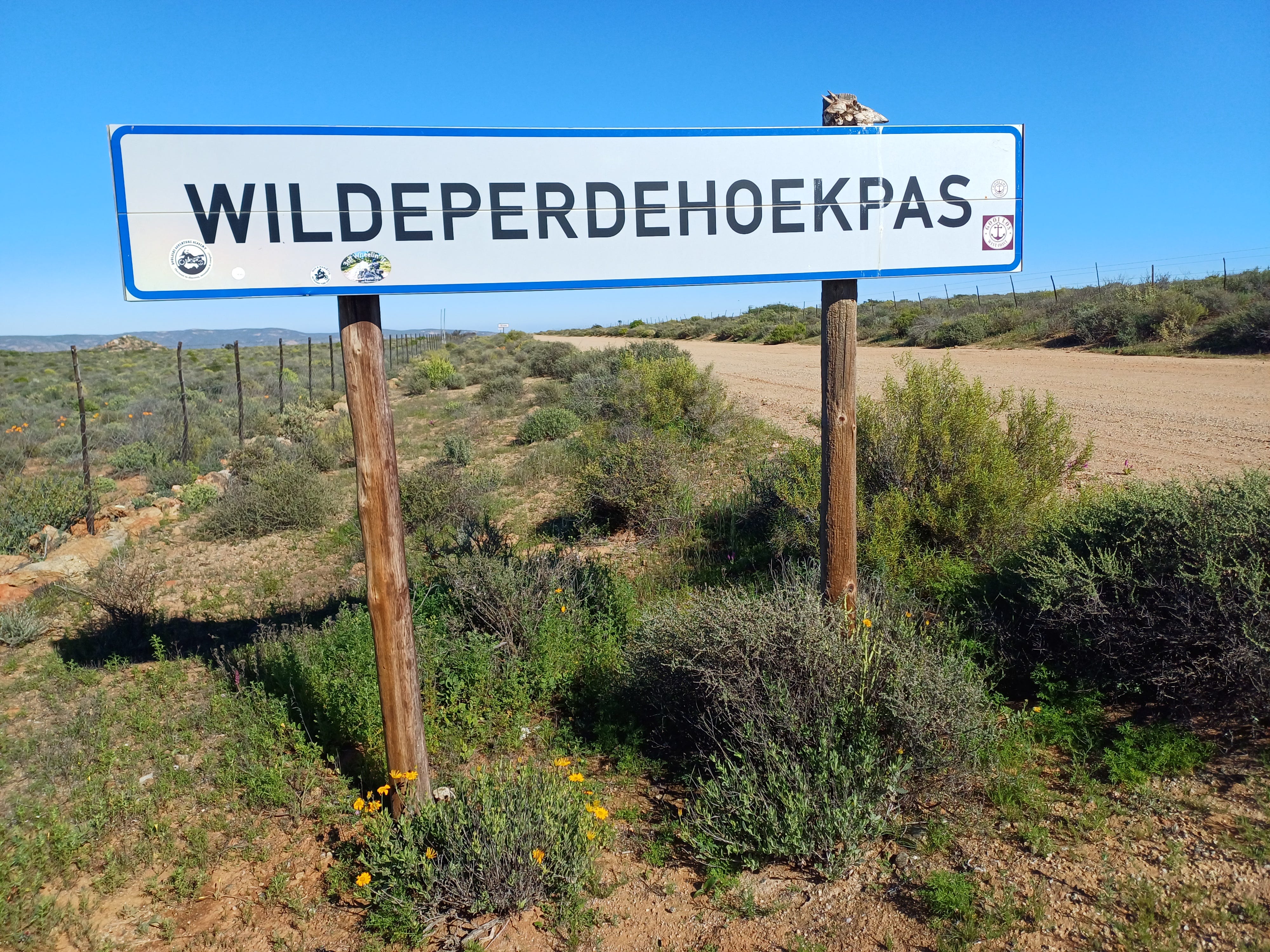
“The best view to be found along the Messelpad… is from the top of the pass that crosses over the mountain at Wildeperdehoek, the glen of the horses. There are no wild horses left at Wildeperdehoek now; a lifetime ago or more the Sandveld farmers wiped them out because… you couldn’t catch them or do anything with them.”34 In hindsight, I should’ve read the two chapters again before driving this route, I missed the Ou Tronk [old jail] and Koringhuis [wheat-storage barn].
As I was looking at my maps (I still use hard copies, in addition to Google maps) in planning my route for day 4, I saw both the Messelpad and Wildeperdehoek Pass indicated, though as separate, linked entities. Also, I looked at online reviews56 and was a bit wary of doing the Wildeperdehoek Pass in my car (which is not a 4x4).
Driving north from Kamieskroon, I took a left turn as indicated by my GPS: a locked farm gate (Droekloof). I carried on towards Springbok, and the same outcome at the next turn-off (Mesklip). The third turn-off hit the spot, the sign said Hondeklipbaai.


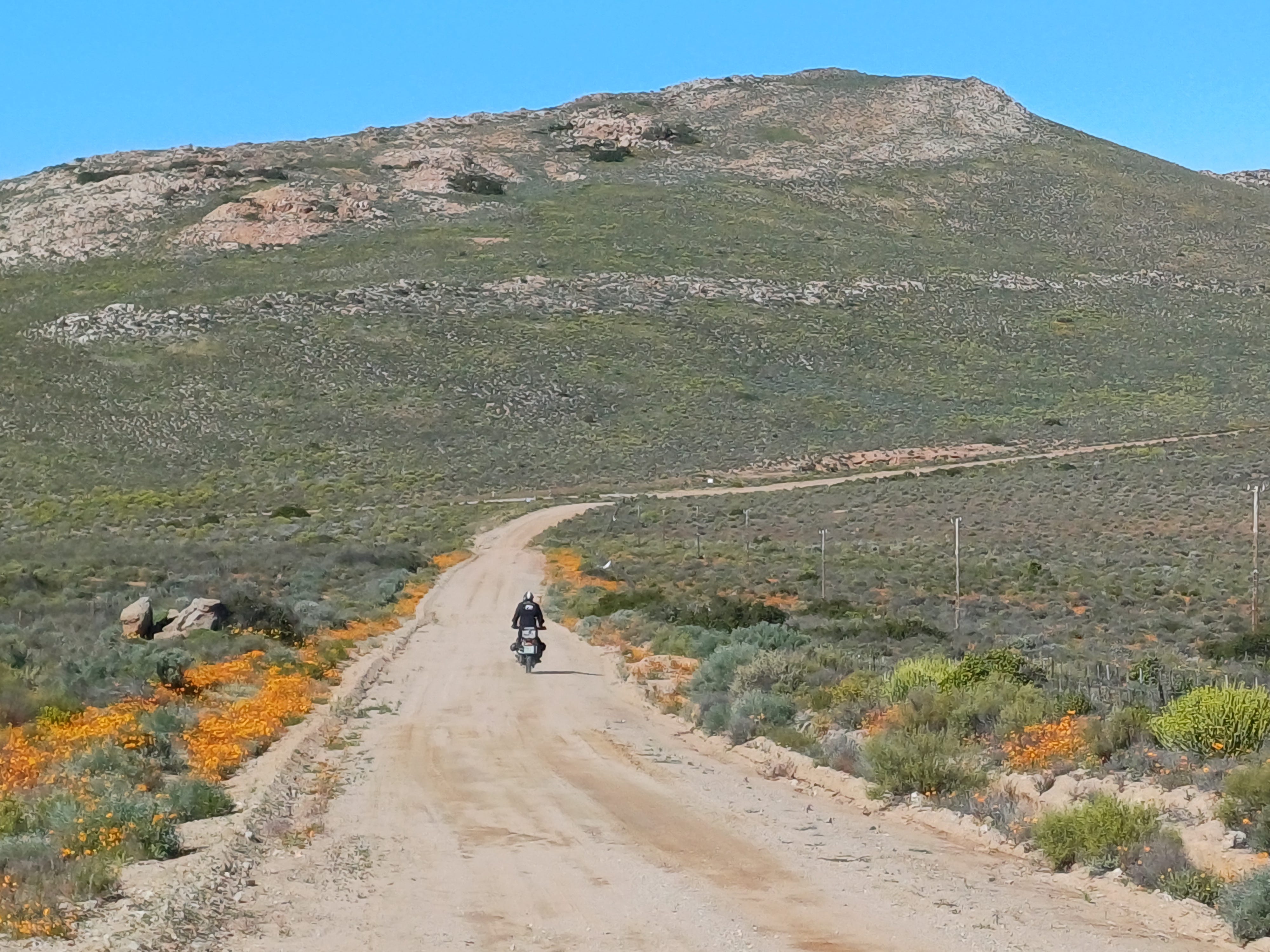
That’s Alan from Okiep on the motorbike, he stopped to have a geselsie [chat] when I was trying to photograph some sugarbirds; he assured me that the pass would not be a problem as I do have a high-clearance vehicle.
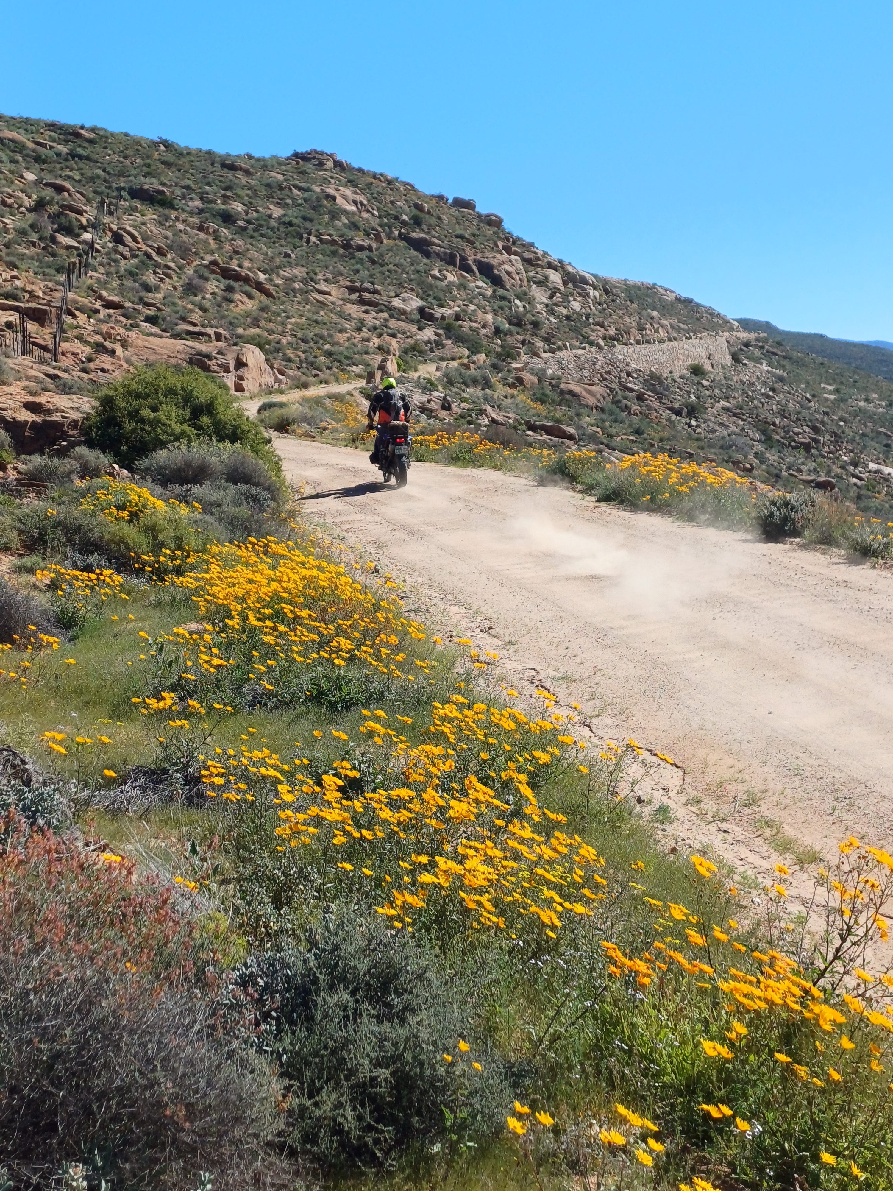
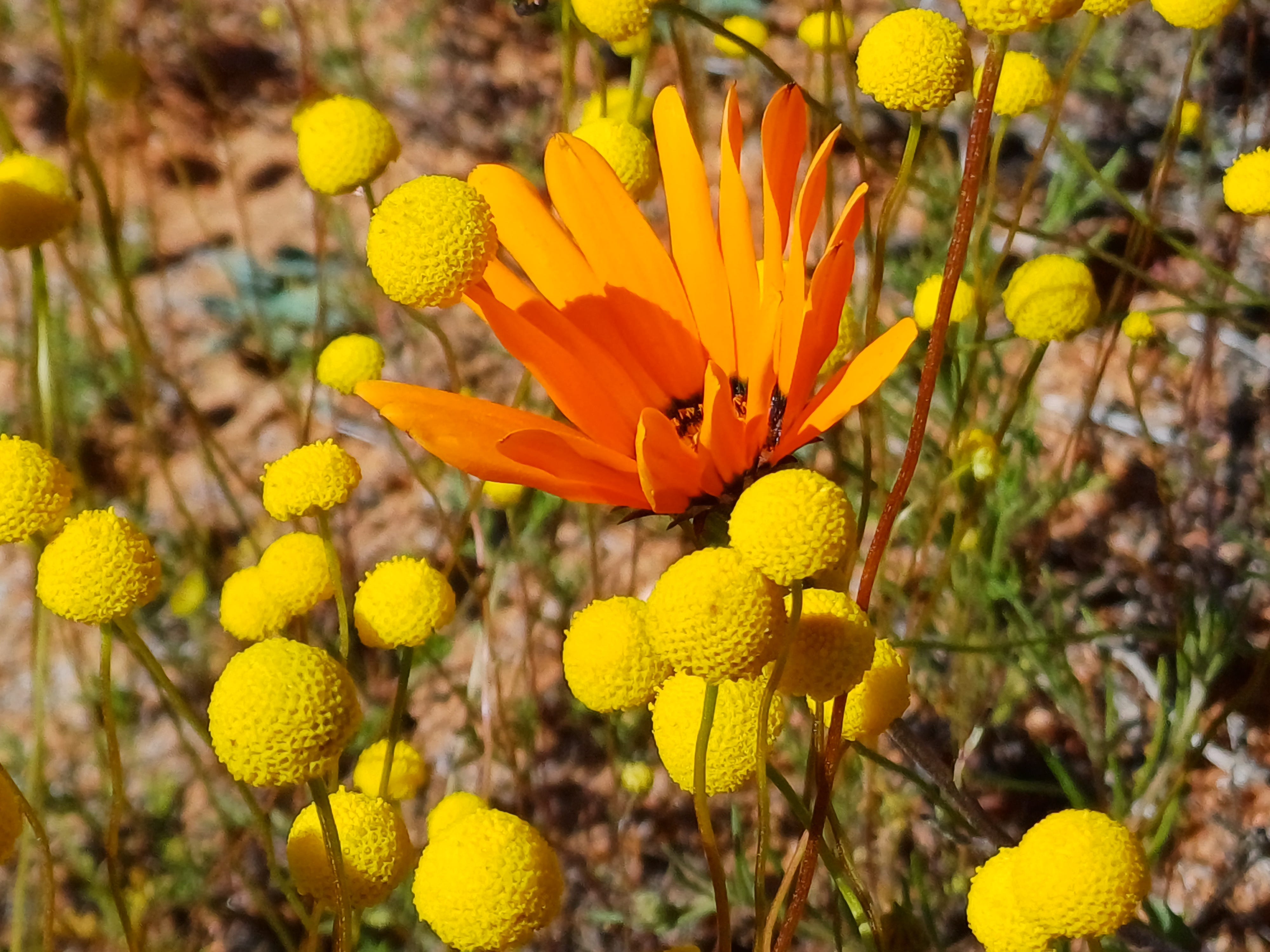
The Wildeperdehoek pass is indicated at 30 km, which may take you a while. I stopped at a koppie [hill], which I noted as “yellow, yellow, yellow, with pink and white succulents [vygies]. Birds, bees, butterflies; at least three species of the latter.”


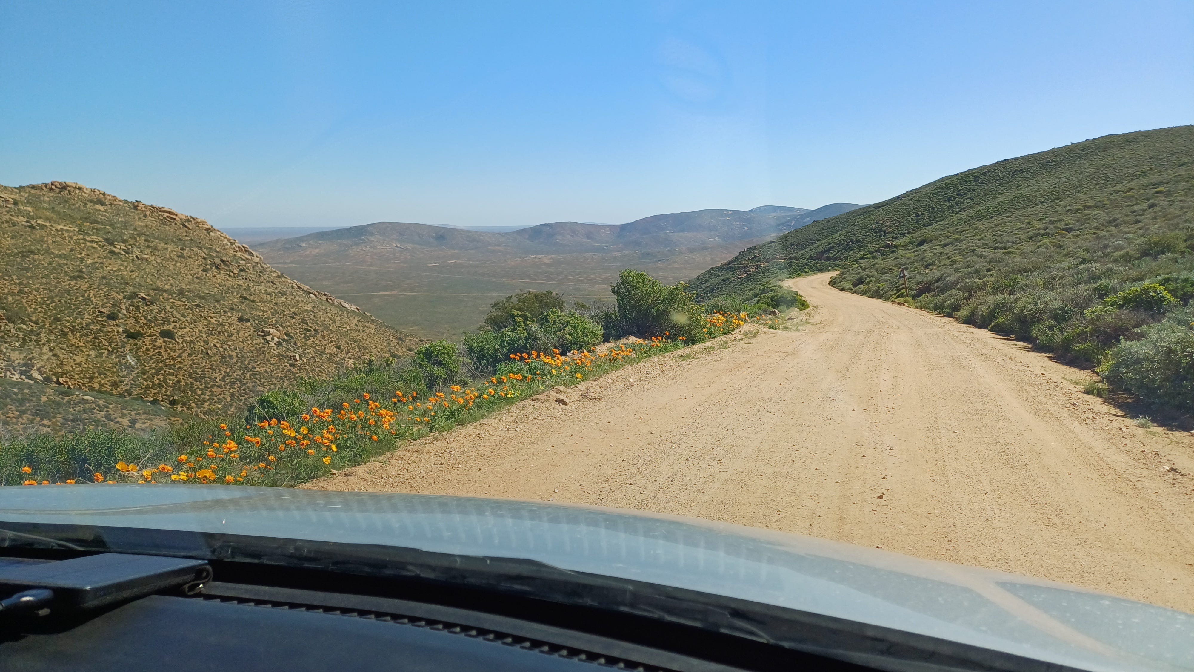
My notes are a little sparse, I did enjoy the pad [road], stopping to take photographs, smell the aromas of the veld and ‘feel’ the place. One can still see remnants of the old Messelpad [masonry road], adorned with those beautiful yellow daisy bushes.
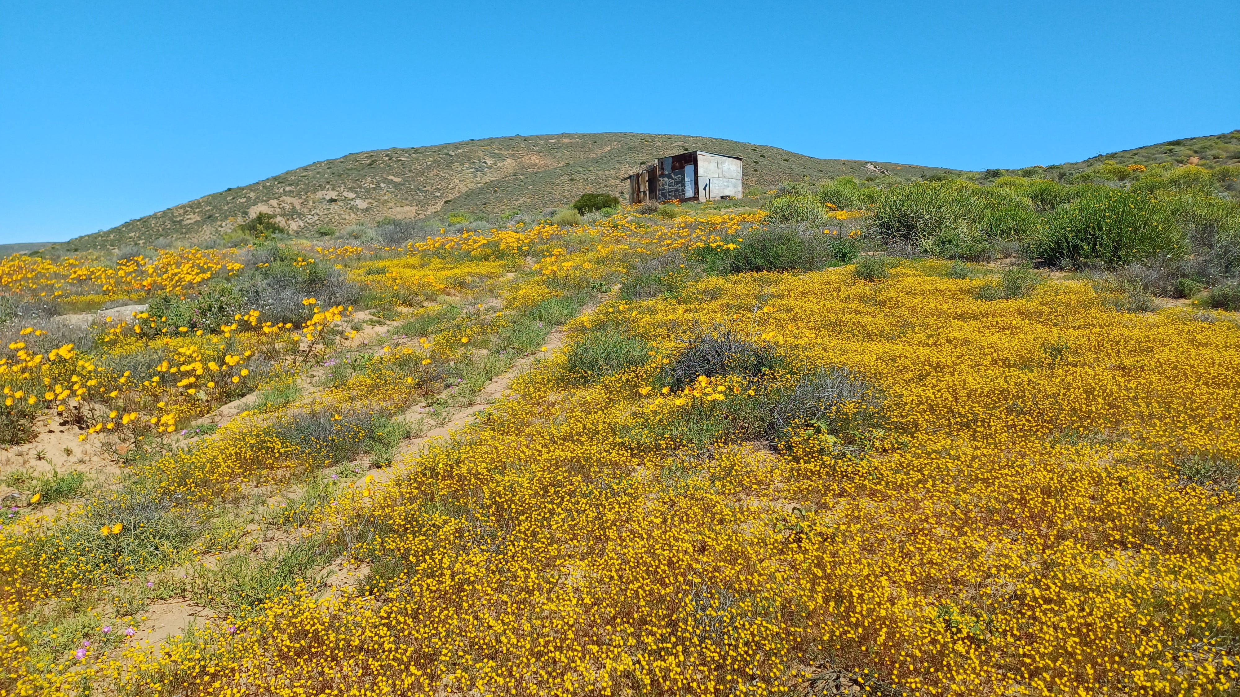
I saw the abandoned shepherd’s hut shown below on a hillside and decided to go have a look (a nearby kraal was empty and the two-track road had not seen a human or car in a long time). A sparse abode, I wonder what stories are hidden here.
The last section of the pass is quite ‘hairy’, quite narrow and a ‘nice’ 200-meter drop on one side. On the plus side, a wonderful view onto the plain below.
Rather than Soebatsfontein, I took the alternative route via Kommasgas. The latter dorpie7 has an abundance of donkeys, it may be the donkey-kart capital of South Africa. I can only imagine how hot it must get in the summer, and bitterly cold in winter.
Land of the Thirst King. Willem Steenkamp. Citadel Press (1975).
Chapter 3: To the Copper Mountain. Land of the Thirst King. Willem Steenkamp. Citadel Press (1975).
Chapter 4: The Copper Road. Land of the Thirst King. Willem Steenkamp. Citadel Press (1975).
Messelpad pass [Wikipedia link]
Komaggas – A Small Town on the Komaggas River in Namaqualand! [YouTube link]
In hindsight, I should’ve read the two chapters again before driving this route, I missed the Ou Tronk [old jail] and Koringhuis [wheat-storage barn].
Well I guess that calls for another trip...:-)
Lovely reading...thank you!